If you shop on Thanksgiving, you are part of the problem
Reply
I love to see the change of seasons. I mean, LA weather is nice and all, but the lack of seasons kind of creates a dreamy illusion of “no change”; a kind of hallucinatory “eternal youth”. Here the seasons repeating cycles create time and link one to reality itself. I’ve been raking leaves and cleaning gutters, but beyond the work required, Fall has it’s own character that really stands out for me. I love it.


Took a walk today, and there, next to the irrigation canal, was a milkweed plant with a dried seed pod that had broken open, spilling it’s silky contents. Now, I haven’t seen milkweed since I was a kid – the dried pods of the milkweed plant were a sign of the end of summer when I was growing up in Ohio.

Southeastern Idaho is very different from Northeastern Ohio. No big irrigation canals there, for one thing. But the milkweed is the same.

So here’s to summer. I’m going to enjoy it while I can.

The Fourth of July parade is an American Tradition. What would our national holiday be without floats, horses, bands, clowns and flags?
This year Sue and I got to experience Pocatello’s version. We found a shady spot on Arthur St. on the steps of the old courthouse, and settled in to enjoy the show.
Here’s some of what we saw:


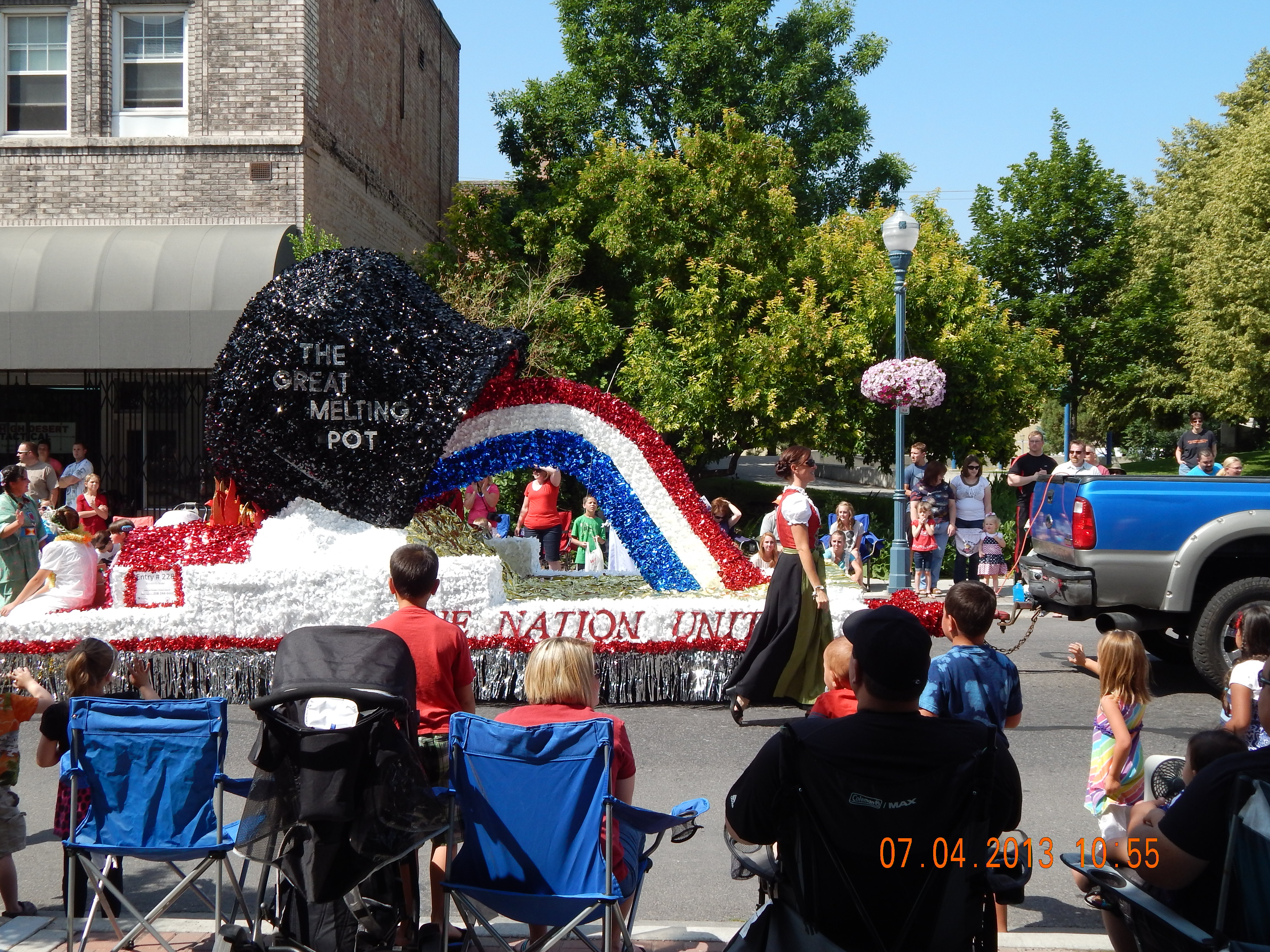


According to the local newspaper, the parade was a big success. According to Sue and I, too.
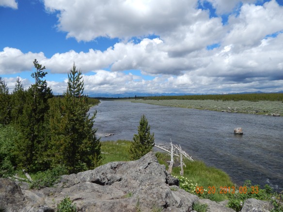
Entered via West Yellowstone and soon found this spot.
A while back I wrote about a hike Sue and I took up “Death Valley”. Today we visited another somber-sounding piece of Idaho real estate, which we found to be quite beautiful.
North of here, between Blackfoot and Idaho Falls, Interstate 15 crosses the very edge of an ancient lava flow known as “Hell’s Half Acre”. For a couple miles, the landscape on either side of the freeway changes from a carefully groomed smooth, open, green to rugged, rocky and wild.
At a rest stop in the midst of this, the BLM has created a set of paved interpretive trails that allow visitors to experience the landscape close up.

This is a rough, rugged landscape. A lot of bare, black, basalt lava with scattered juniper trees and sage brush.

This would not be easy country to cross. As the surface of the lava cooled, it hardened. As the still-hot lava beneath the surface flowed away, the surface was left unsupported and it collapsed, leaving a rough, tumble-down terrain.

Above, you see that as the surface of the flowing lava cooled and hardened, it left a wrinkled, washboard appearance.

Here you can see the struggle plants have to live here. on the right you can see some of the moss and lichen that are slowly turning the rock into soil.

We did see some wildlife. If you look very carefully, in the very center of this photo you can see a rabbit, well camouflaged. (And a good thing too – we saw hawks circling overhead earlier.)

Here’s a different sort of wildlife. We didn’t see the spiders, but we saw several very beautiful webs.

And that was our afternoon. If you ever get the chance, I recommend a visit.
You know, when Bowie originally released “Space Oddity”, the Apollo moon landing, Space Shuttle and International Space Station were all in the future. Just Science Fiction. Watch this and realize that now is the future. Wow.
A while back Sue and I went to an Earth Day festival at a local park. I met a guy there who told me about a really nice hike further up the City Creek drainage – a trail called “The Grove”. So today I decided to check it out.
I took a bunch of photos to give you an idea of what it was like
The area is mountainous and in the lower areas it’s grassy with scattered juniper trees:

The area is criss-crossed with single track trails like this. Here we’re looking down City Creek towards the Portneuf Valley.
Here’s another view back down the road toward the valley:

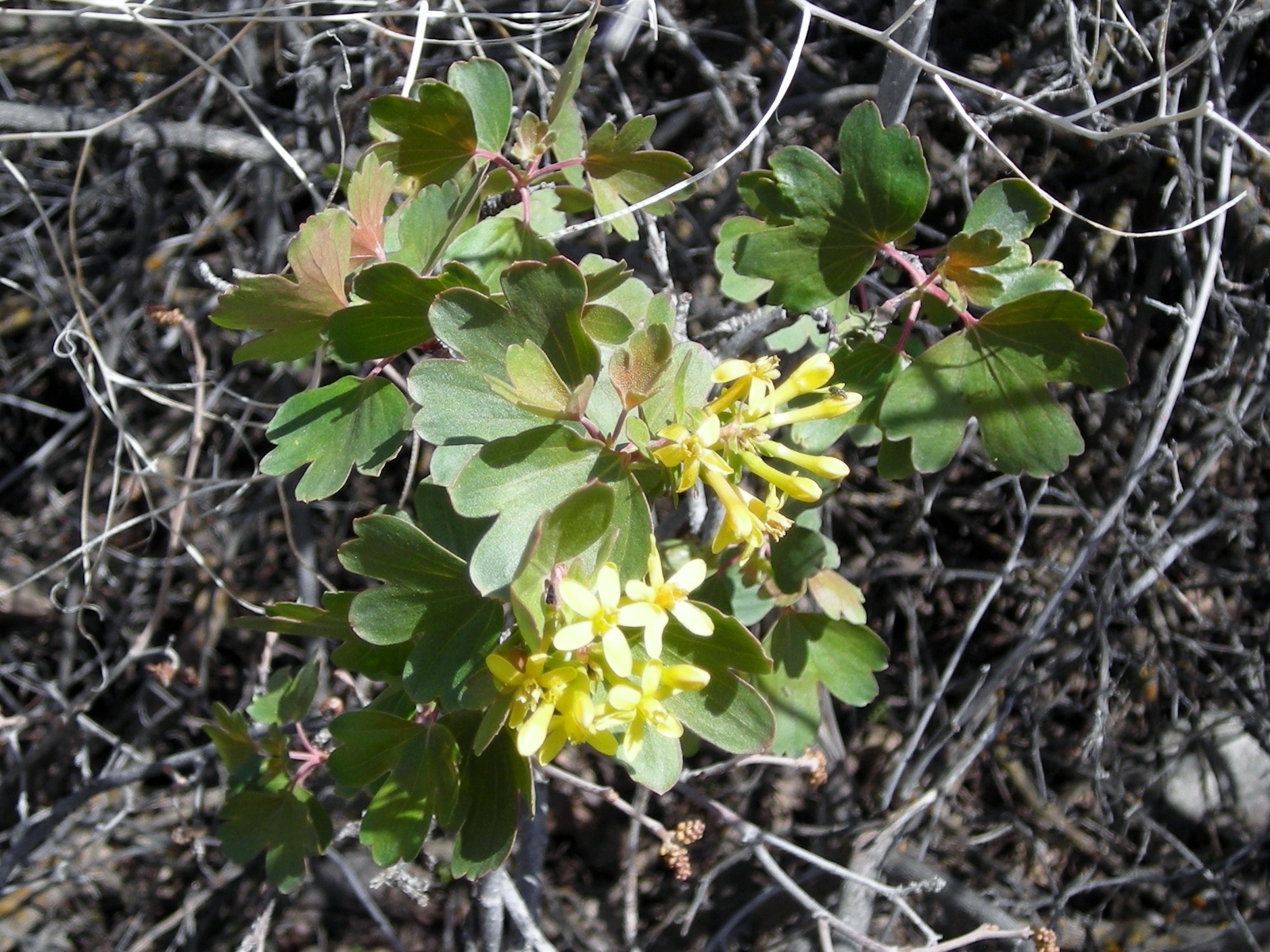
The junipers of course are evergreen, but spring is just starting to show here in the higher altitudes, with a few wildflowers and deciduous trees just starting to show buds and leaves. Here’s some wildflowers I found:
Here’s looking up the canyon – getting green, but still not a lot of leaves.


I was paid a visit from this butterfly, who was kind enough to stay still long enough for me to get a picutre:
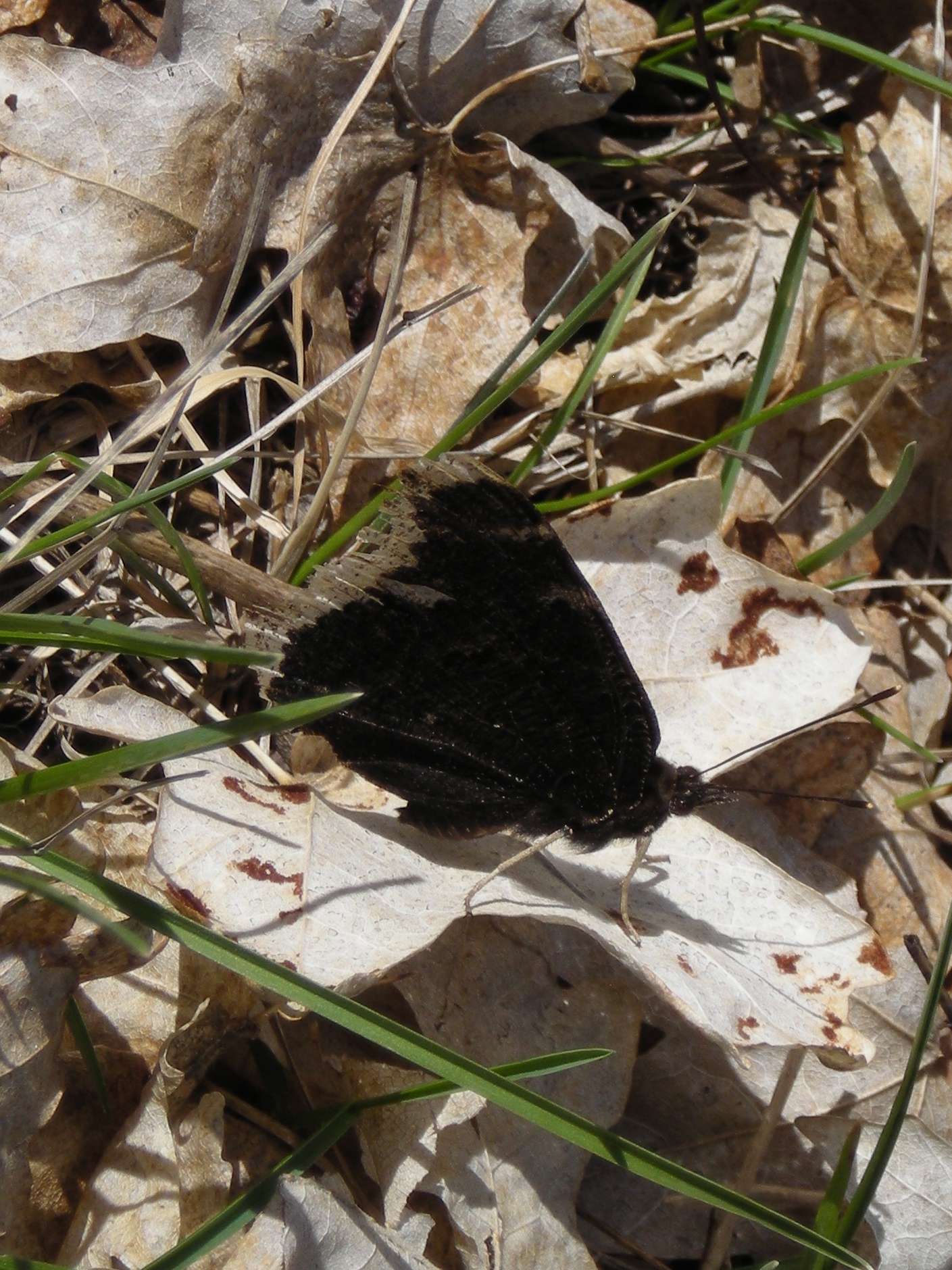
I was told that “The Grove” from which the trail takes its name, is an aspen grove, I didn’t see many aspen, but I saw quite a few maples, as well as a variety of other trees.

Here’s a look back down the valley towards home:

This was as far as I got before I had to turn around and go home. However, with all the miles of trails up here, I’m sure I’ll be back!

On the way back, I took this panorama of the road home.

So that’s it – I had a great time and hope you enjoy this post!
Today was such a beautiful day that Sue and I decided to take a walk. One of the things I really like about Pocatello is the easy access to hiking trails. I think I’ve already mentioned the Portneuf Greenway, which is a system of urban parks and trails being developed next to the Portneuf River where it winds its way through the city.
There is also a system of trails the city is developing on Pocatello City and BLM Property in the foothills immediately southwest of the city – The City Creek Trail System.
On the recommendation of a friend, we set out for a trail called “Death Valley”.


It’s really quite pretty. I can’t figure out why it’s called “Death Valley”.


After hiking a half mile or so, we found a side trail that took us up out of the ravine onto the ridge above. Here’s a shot from there. You can see how close the city is. (That’s Idaho State University in the distance).

Looking in the direction opposite the city, here’s a view of the mountains southwest of town:

Once we got back to the car, Sue and I decided to explore a little of the Greenway. Here’s a little park on the Greenway, right on City Creek.

Here’s the Portneuf River, near where City Creek flows into it:

This section of the Greenway features some of the interesting Geology of the region. Once, until about 15,000 years ago, most of Utah was covered by Lake Bonneville. Then about 15,000 years ago, the “lake” (actually an inland sea), breached a natural dam southeast of the present site of Pocatello, and over an 8 month period, thousands of cubic MILES of water poured through the Portneuf gap just south of Pocatello and eventually found its way to the Pacific Ocean. This flood carried with it many large boulders from south of here. Here’s just one that is visible here on the Greenway. at “Prehistoric Park”:

Here’s another little park on the Greenway – Pioneer Park, dedicated to the early pioneers who settled here. In the background is “Old Town” Pocatello. You can see the old Union Pacific Railroad Depot in the background.

It was a beautiful day and a really nice walk — I’m looking forward to doing more. See you then!
Today the daffodils started to bloom!

Spring looks like it’s here to stay. Not only are the daffodils blooming, but a couple days ago Sue and I took a walk and found some of our local fields are turning green.
x
It’s great to live in the country. Here’s another shot of Sue on our walk inspecting a weeping willow that’s budding and about to welcome spring.

I hope that wherever you are, spring is as beautiful as here.
